

By continuing to use this site, you agree to our use of cookies.
Driving to Alaska Guide

Aug 24, 2023
In:
Can you drive to Alaska?
Are you ready for an unforgettable adventure? While Alaska may not be the first destination that comes to mind for a road trip, it is possible to drive there. Before you set off, there are some important things to keep in mind for a safe and enjoyable trip. Keep reading to learn the best routes and times of year to travel, plus some tips to make your journey safe and fun.
Driving to Alaska for a move? Learn how to turn your move into a fun family road trip.
How to drive to Alaska through Canada
There are many different routes you can take, depending on your preferences and where you're starting. Let’s explore the two most common paths, which involve crossing the border in Washington State:
The Alaska Highway
The most popular option is the Alaska Highway (also called ALCAN Highway or Alaska-Canadian Highway). The highway is around 2,000 miles long — going from Dawson Creek, British Columbia, Canada, to Delta Junction, AK — and includes several roads like BC-97, Yukon 1 and AK-2.
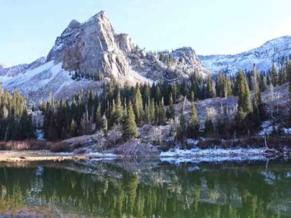
To get to the highway, cross the U.S. border at Seattle, Washington, head north to Prince George, BC, and connect with Highway 97 to get to Dawson Creek. This route will take you through some stunning scenery, including the Rocky Mountains and the Yukon Territory.
Sightseeing opportunities along the route you won't want to miss:
- Haines Junction
- Kluane National Park and Reserve
- Liard Hot Spring Provincial Park
- Muncho Lake
- Sign Post Forest
- Yukon Wildlife Preserve
The Stewart – Cassiar Highway
If you want to see a lot of wildlife and encounter less traffic, consider taking the Stewart – Cassiar Highway from British Columbia for the first part of your drive. It’s a rugged stretch that runs about 450 miles and connects with the Alaska Highway near Watson Lake. Although this more remote and less-traveled route is about 130 miles shorter than taking the Alaska Highway for the whole journey, it can add up to two hours to the drive.
For this route, cross the U.S. border at Seattle, Washington, and take BC-5 N to Prince George, BC. From there, take BC-16 W to Kitwanga, BC, to connect with the Stewart – Cassiar Highway (BC-37 N). Around Watson Lake, you’ll connect with the Alaska Highway for the rest of the trip.
Things to see on or near the Stewart – Cassiar Highway:
- 100 Mile House
- Barkerville Historic Town
- Coquihalla Canyon Park
- Hell’s Gate
- Jade City
- Williams Lake
Tips for the road
No matter which route you choose, you’ll want to have some Canadian currency and proper documents (passport, prescriptions, pet health certificates, etc.) to cross the borders (both Canada and the U.S. when you get to Alaska). Check out these tips for crossing the Canadian border by car.
Here’s some more advice for the drive:
Confirm cell phone coverage
Check with your mobile provider about coverage in Canada and Alaska. Some phones need an international plan to work in Canada, and roaming charges may apply in Alaska, depending on your service provider. Most hotels and campgrounds will have wired internet service or Wi-Fi. But note that cell coverage can be spotty in many areas.
Check weather and road conditions
Before setting out, check weather and road conditions to be ready for the drive. You may need to pack special gear or reroute to avoid any issues.
Plan for fuel and lodging stops
Gas stations and lodging can be scarce on the way to Alaska, so it's helpful to plan ahead and make sure you have a place to stay overnight and enough gas to get to the next stop. In Canada, fuel is measured and priced per liter (around ¼ of a gallon), and most stations will be pre-pay only.
Pay attention to speed limit and road signs
No one wants a speeding ticket to spoil their fun on a road trip, so keep a close eye on your speedometer, especially in Canada where speed limits are posted in kilometers per hour. Some vehicles have both miles and kilometers displayed, and others might have the option to switch the measurement on the speedometer (check the vehicle manual for directions). Watch for Canadian road markers, which typically appear every two kilometers, but some signage may be missing during construction periods.
Be aware of wildlife
It’s common to see wildlife, particularly moose and caribou, along the roads. Pay attention to your surroundings and be prepared to stop for animals that might enter the roadways.
Protect your things
In the winter, it’s best to avoid leaving anything in the car overnight (or for extended periods) that can be harmed by the cold, like water bottles, electronics and plants. And if you’re camping instead of staying in a hotel, it’s important to secure your food to avoid attracting wildlife.
What is the best time of year to drive to Alaska?
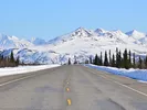
It’s best to drive to Alaska during the summer months if you can. Road conditions are most favorable during this time, and many of the businesses along the routes are seasonal and will be open from June – August.
The highways to Alaska are open year-round, but winters up north can be extremely cold with a lot of icy precipitation. Snowstorms can still happen in the spring and fall, so if you must travel outside of summer, there could be delays due to weather and road conditions.
Preparing your car
Making sure your car is road trip worthy for a drive to Alaska is similar to preparing it for other long trips. You’ll want to ensure the car is in good working order by having a mechanic inspect the engine and tires (or following a car maintenance checklist to do it yourself). It’s essential to have emergency supplies and equipment with you, like extra food and water, a first-aid kit, blankets, emergency lights, jumper cables, a spare tire and tow straps.
There are some additional things to consider for a drive to Alaska:
- A printed map (GPS signals can cut out)
- Two-way radios (helpful if you’re traveling with others in separate vehicles since cell reception is minimal in some areas)
- Winter tires (these are required in British Columbia from October 1 – April 30)
How long does it take to drive to Alaska?
The drive from the U.S. border in Washington State through Canada to the Alaska border will take approximately 36 – 38 hours. Just add the distance from your starting point and the distance to your final destination to get an estimate for the total driving time.
Of course, any stops or sightseeing detours will extend your journey. Allowing extra time for overnight stops and unexpected travel delays is a good idea. You never know when a herd of caribou might stroll across the road and back up traffic!
How to take your car to Alaska without driving through Canada
If you want a break during your drive to Alaska, you can take an Alaska Marine Highway ferry from Bellingham, Washington. The time you spend on the ferry will depend on your port destination in Alaska, but you’ll have the opportunity to rest in one of the sleeping cabins, lounge chairs or even in your own tent on the deck of some boats.
The ferry ride from Bellingham, WA, to Ketchikan, AK, is approximately 38 hours, and continuing to Juneau will add another 20 hours. Depending on your final destination in Alaska, you might have to take additional regional ferries until you reach a city with roads that connect with your destination.
You won’t need a passport for the ferry unless you’re planning a stop in Canada.
Ready to make the drive to Alaska?
Whether you’re moving to Alaska or making the trip for fun, it’s quite a journey. Let us know in the comments what you’re most excited about doing along the way.
More articles you might like...